
Magnum GSI provides specialist geological, geotechnical, and hydrogeological assessment. A key aspect of this is scoping, planning, and designing of targeted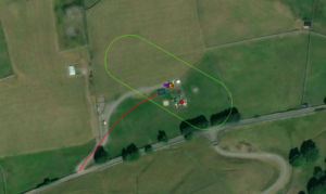 ground investigations. We provide comprehensive consultancy services from desk study assessments where we outline the purposes and goals of the ground investigation, through to the design of the ground investigation. In addition, we have geoscientific experts to manage and supervise any ground investigation contracts. Our multidisciplinary approach leverages extensive expertise across various disciplines, including geospatial field data deployment and collection, to deliver high-quality, efficient, end-to-end services to our clients.
Our Services
Magnum offers an extensive suite of services in ground investigation planning, design and management, focusing on every factor crucial to a successful delivery ground investigation. Our services include:
Geoscientific desk study assessment: identifying the focus points of a Ground investigation.
Scoping and design of targeted ground investigations: including geophysical surveying to characterise subsurface conditions effectively and as well as more traditional intrusive techniques.
Ground investigation contract and tendering management: providing support in pricing and procurement of ground investigation services from ground investigation contractors.
Ground investigation supervision and management: Suitable trained geoscientific experts are available to provide technical support and management during the ground investigation activities including installation and monitoring advice.
Stakeholder engagement: to ensure efficient operation and communication.
Our Approach
Our team of seasoned professionals utilizes cutting-edge equipment and software to ensure a comprehensive characterization of a site. Our approach includes:
- Integrating and assessing all available geological, hydrogeological, geospatial, and infrastructure data to identify key site constraints.
- Scope and design a targeted ground investigation – including geophysical surveying, traditional intrusive techniques, in-situ testing, monitoring and laboratory testing.
- Employing real-time geospatial data capture using ArcGIS Field Maps, updated and uploaded to our bespoke online viewing platform through all phases of works.
- Magnum’s on-site drilling supervision, ensuring targeted geological and hydrogeological horizons are intercepted and reporting geology. In addition, any variations in expected ground conditions can be recorded, and where necessary ground investigations redesigned accordingly.
- Post-drilling, our expert geoscientists review the findings of ground investigations and provide details of monitoring installations and laboratory testing to be undertaken.
- Following completion of the ground investigation and monitoring our expert geoscientists will provide a geoscientific report outlining the findings of the investigation.