

GeoScreen has, until now, been an England-only product. That was a deliberate scope decision at launch — better to be reliable across one nation than thin across three. As of this update, that scope has grown: GeoScreen now covers Wales, with the same rule-governed rating engine, the same figure set, and the same discipline about what the platform will and won’t claim.
This post is less “we added a country” and more “here’s what that actually took,” because the honest answer is: more than swapping one dataset for another.
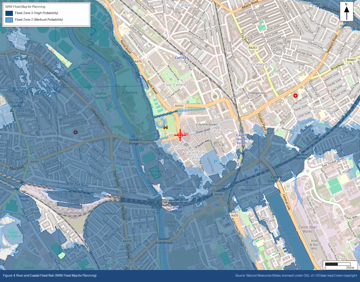
The datasets had to change, not just the labels. Not every source did — BGS geology and the UK’s coal mining authority already cover the whole of Great Britain, so those needed nothing at all. But the Environment Agency data GeoScreen relies on — flood risk, landfill sites, groundwater source protection zones, and more — is England-only, and its Welsh equivalents from Natural Resources Wales aren’t drop-in replacements: different agency, different schemas, different licensing terms, and in at least one case, a different underlying product entirely. Flood risk is the clearest example: England’s statutory planning flood product and Wales’s don’t share an API, a schema, or even the same conceptual dataset. Natural Resources Wales publishes two genuinely different flood products, and our first pass queried the wrong one — a risk-banding tool, not the statutory planning product. We caught it before it shipped, by checking a real site against both and finding they disagreed. That’s the kind of thing that’s easy to get wrong quietly and hard to notice unless you go looking for it.
Heritage and ecology designations map to different bodies with different grading systems. Historic England becomes Cadw. Natural England becomes Natural Resources Wales. Planning policy stops being the NPPF and becomes Planning Policy Wales — which, worth noting, structures flood/heritage/ecology guidance completely differently (one combined chapter, rather than three separate ones), so this wasn’t a find-and-replace job on section numbers.
We found and fixed a genuine data-accuracy bug during testing that’s worth being upfront about. Several of the underlying Welsh datasets are queried via a spatial filter that, per the international standard it follows, matches on a feature’s bounding box rather than its actual shape. For a small, compact feature that’s a non-issue. For a large or irregularly-shaped one — a river catchment, an estuary designation — it can produce false positives well outside the real search radius. We caught this because a direct question about whether a specific designation was really within range of a specific site turned out to have the answer “no, not even close” — the bounding-box match was picking up something over 20km away. Once found, we checked every dataset using the same query pattern, not just the one we happened to be looking at — and found the same false-positive risk had, in one case, been enough to change an actual flood risk rating for a real site. Fixed with a proper distance check, not just a box check, before anything shipped. It’s exactly the kind of subtle correctness issue that only surfaces when you go and check a real answer against real geography rather than trusting that “the API returned a result” means “the result is right.”
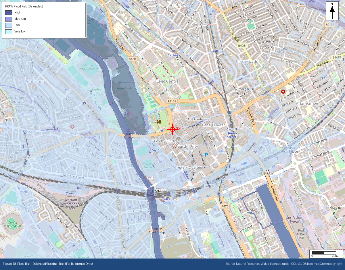
Digging into that flood dataset also surfaced something the platform had never actually explained, in either nation. Statutory planning flood maps — the ones every GeoScreen rating is built on, in England and Wales alike — deliberately ignore existing flood defences, because a planning decision has to hold up over a development’s entire lifetime, and defences can fail or be overtopped. That’s the right basis for a geotechnical rating. But it also means the map a planning system uses can look more alarming than the “current risk” a public flood-check tool shows for the same postcode, and until now nothing in a GeoScreen report explained that gap. Every report now includes a reference-only figure, in both nations, showing the defended/residual view alongside the statutory one — Natural Resources Wales’s own risk-assessment dataset for Welsh sites, the Environment Agency’s equivalent for English ones. It doesn’t change a single rating; it exists so that if you cross-check GeoScreen’s output against a quick public lookup and the two don’t match, you’re not left guessing why.
What this means for you: if you’re working on a site in Wales, GeoScreen now gives you the same 11 geohazard RAG ratings, the same 18 annotated figures, and the same rule-governed narrative as an English site — sourced from NRW, Cadw, and Welsh planning policy rather than their English equivalents, with the same “no invented precision, no overstated confidence” discipline the platform has always held itself to. Verified end-to-end against a real batch across both nations before going live.
Scotland is next on the roadmap. We’re not going to rush it — the Wales build reinforced that “the licence is open” and “the data means what you’d assume it means” are two different questions, and we’d rather ship a nation’s worth of coverage once than fix it in public.
See it on a real Welsh site. The Cardiff report used for the figures above is available to download in full, in both Tier 0 and Tier 1 form, at geoscreen.uk — or order a report for your own site in Wales, from £75 + VAT.
Tristan Morgan BSc(Hons) EurGeol CGeol FGS AMICE is a UK Registered Ground Engineering Specialist and Director of Magnum GSI Ltd. GeoScreen® is an automated geotechnical ground risk screening platform available at geoscreen.uk.
